
An expansive view of San Diego County. A shaded and well-maintained trail. A rock shaped like a potato chip. All of this was found on this week’s hike to Mount Woodson.
Located in Poway, Mount Woodson is a roughly 2,900-foot peak that is widely known for its “Potato Chip Rock,” the uniquely shaped rock near the top of the mountain.
This hike — a roughly 5.8-mile loop — follows three paths: Mt Woodson Road, a paved service road on the eastern side of the mountain and Mount Woodson Trail and the Fry-Koegel Trail, dirt trails that wrap around its western and northern slopes.

Mount Woodson is named after Marshall Clay Woodson, who reportedly served in a medical capacity for the Confederate Army during the Civil War and moved to Ramona from Kentucky in the 1870s.
But well before that, the Kumeyaay people referred to the mountain as Ewiiy Hellyaa, translated in English to the “mountain of the moonlit rocks” or “moon mountain.” For the Kumeyaay, the mountain was known as a place of power.
To begin, park near the Mount Woodson trailhead on State Route 67. Parking is only available along the highway, though a parking lot is currently under construction. The trailhead is located on the western side of the road, just south of the Cal Fire Ramona station, and is marked with a wooden sign pointing to Potato Chip Rock.
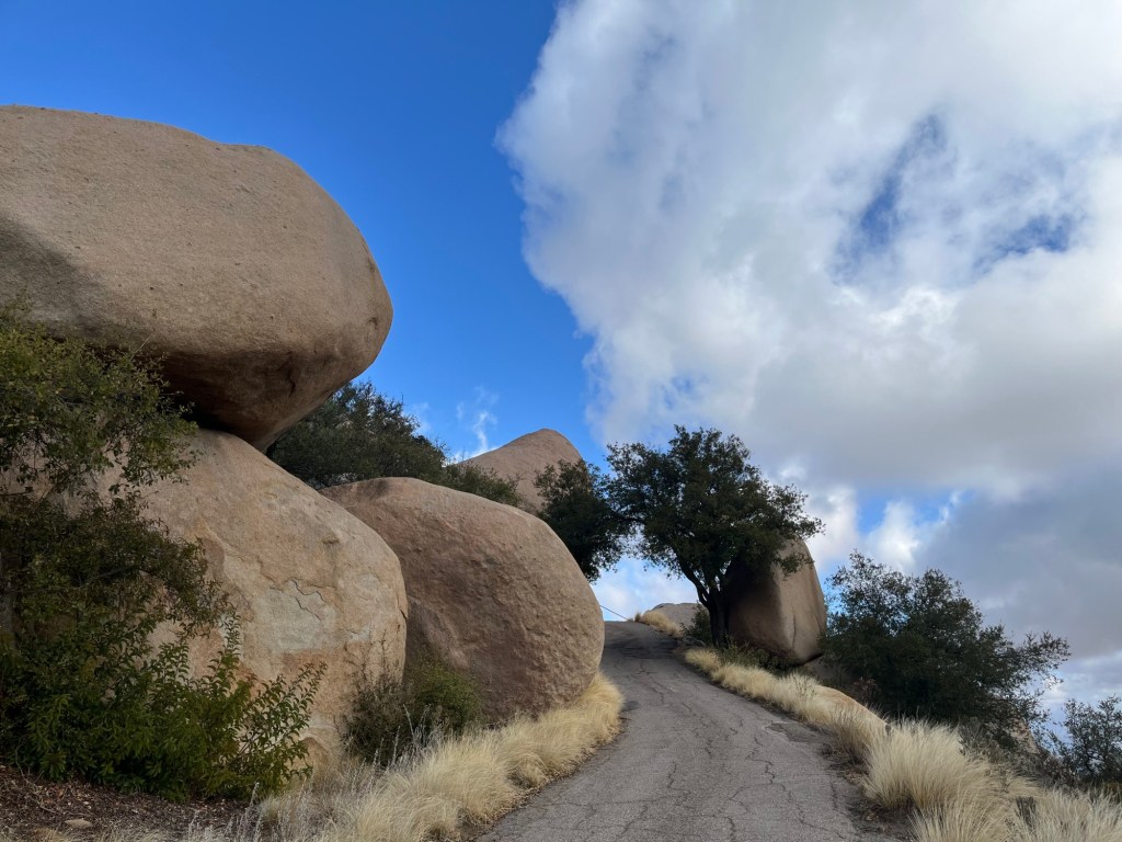
Walk for about 500 feet on a dirt trail parallel to the highway before reaching the paved Mt Woodson Road, which hikers will follow for about 2 miles to reach the peak.
It’s a tough climb, so take breaks and admire the surrounding open space, including the Ramona Grasslands County Preserve in the distance to the northeast and the manzanita and giant boulders that line the road. Mount Woodson has long been a favorite spot for rock climbing, and many crags can be accessed from this road.

After hiking about 1.7 miles, you’ll reach the radio tower-clad summit. Follow the paved road past the towers and down toward Potato Chip Rock, located on the right side of the path around the 2-mile mark. It’s fun to scramble onto the rock for a photo — but be careful doing so, and expect a long wait on busy weekends.
To start the return hike, walk down past Potato Chip Rock until you reach the Mount Woodson Trail that heads to the Fry-Koegel Trail, Ridge Junction and Lake Poway — all of which is marked on a sign. Take the trail for about 0.9 miles until the intersection with the Fry-Koegel Trail, which is also marked.

It’s a lovely hike down the mountain. As hikers near the end of the Fry-Koegel Trail, they’ll walk near residential homes and pass by the Mt. Woodson Golf Course.
The trail ends on Archie Moore Road, near the entrance to the golf course, and hikers will need to use caution as they walk along the road and State Route 67 for about 0.4 miles back to their vehicle.