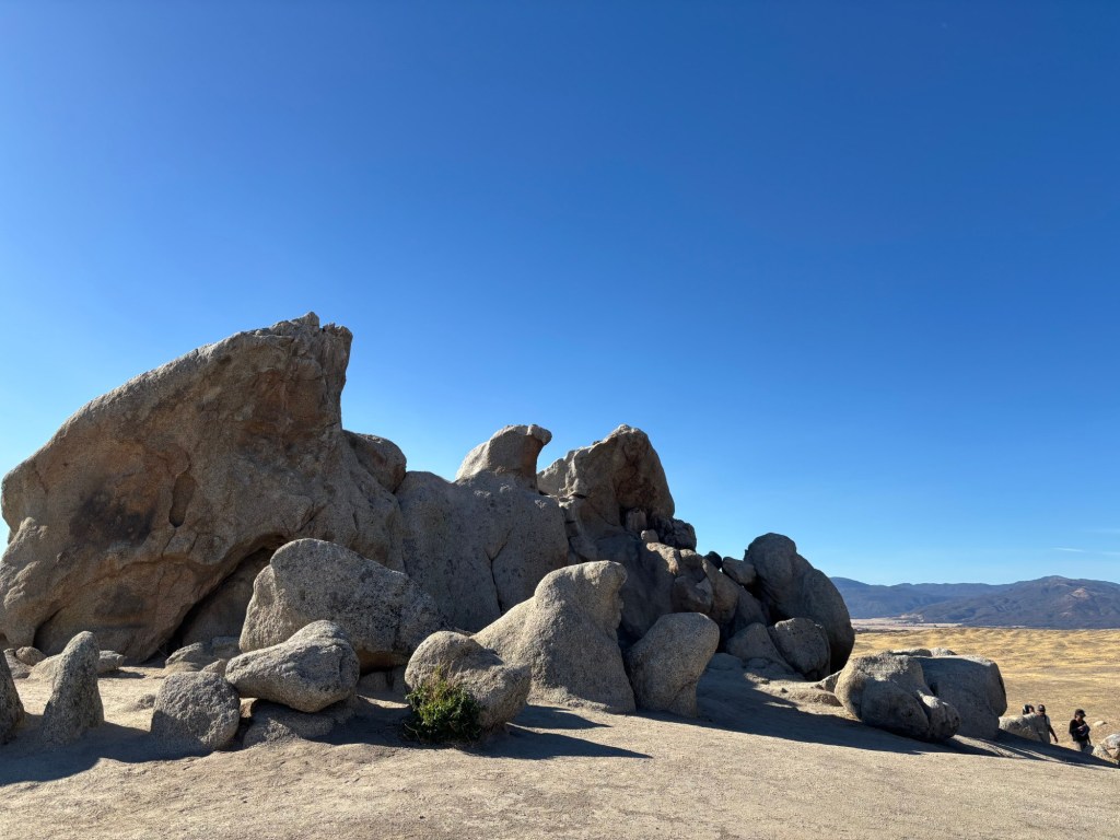
Nothing beats a new year’s hike, especially one as accessible and rewarding as the journey to Eagle Rock.
Located in Warner Springs, the roughly 6.5-mile out-and-back hike travels to a formation of granite rocks that resembles — uncannily — an eagle with its wings outstretched. To get there, hikers walk a section of the Pacific Crest Trail that meanders leisurely under oak trees, along a creek and passes grazing cows.
It’s an easy hike, though its mileage could increase its rating to moderately strenuous. Dogs are allowed here on a leash, and the trail is wide enough for strollers. You may encounter equestrians out there, too.
I’ve wanted to hike to Eagle Rock for months and am glad it was my first hike of 2025. The experience, including the drive from San Diego that passed through Ramona and by the Santa Ysabel County Preserves, was a reminder of just how much open space we have here in San Diego County and how much more I can explore in the new year.
Plus, there’s something extraordinary about Eagle Rock, and it gave me a sense of wonder that I’d like to take with me over the next 12 months.

The trailhead is located off State Route 79, directly next to the Warner Springs Fire Station. There isn’t a parking lot for the trail, but hikers can carefully park on the side of the road or at the Warner Springs Community Resource Center.
Hikers will easily find the trailhead, which is marked with a gate and large kiosk.
This hike is special because it covers about 3 miles of the Pacific Crest Trail, the roughly 2,650-mile long-distance route that travels from the U.S.-Mexico border to Canada. During the spring, day hikers headed to Eagle Rock may encounter thru-hikers — those who are hiking the 2,650 miles in an extended backpacking trip, which takes about four to six months.

Begin walking on the trail as it heads southeast. It’s mostly flat, with some small rolling hills. The first part of the hike features shade from oak trees, as well as the refreshing sound of a creek flowing beside the trail. I also saw several adorable cows, including calves, grazing amongst the trees and in the distant fields.
Around the 2-mile mark, the trail becomes more exposed and open grasslands take up the scenery. On the day I hiked, it was extremely windy, so check the weather before you go and consider bringing a windbreaker jacket.

Smatterings of rock formations become visible in the distance around the 3-mile mark, and after a final push up a small hill, hikers will reach Eagle Rock. This is a popular destination, so you may not find solitude at the imposing rock formation. But that doesn’t take away from its grandeur.
Once you’ve enjoyed the sight, and perhaps rested on a rock for some lunch, retrace your steps back along the Pacific Crest Trail to your vehicle.


