Southeastern San Diego would get floodable parks, wet plazas, cloudburst roads and green schoolyards under a new proposal that aims to prevent flooding by making the area’s infrastructure more like a sponge.
The proposal, called the Chollas Blue Green Vision, could also help solve the scarcity of parks in the area by shifting flood control infrastructure projects from old-fashioned concrete to nature-based projects with grass and dirt.
The initiative is named for the sprawling Chollas Creek watershed, an area that includes much of southeastern San Diego, most of Lemon Grove and parts of La Mesa.
The area includes many of the neighborhoods flooded by an intense downpour in January 2024 that did millions of dollars in damage and left many homes uninhabitable.
Community leaders and local agencies like Caltrans and the city of San Diego plan to unveil the Chollas Blue Green Vision in March, after many months of negotiation and debate over recommended projects and their locations.
While the vision will include a variety of innovative ideas like road medians designed to absorb enormous amounts of excess water, many of its recommendations will be simple and straightforward.
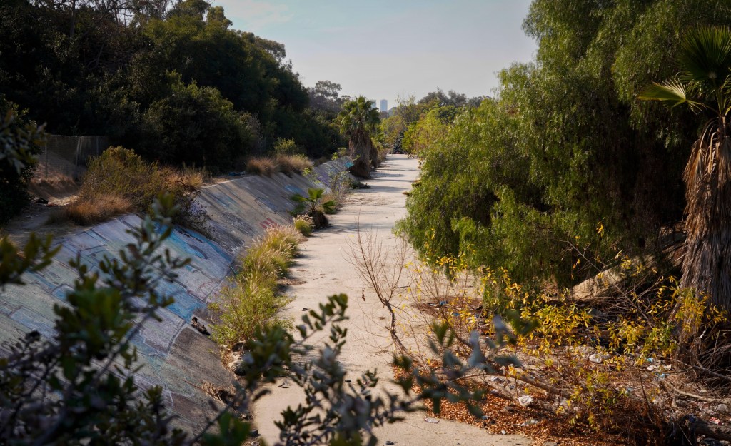
Those include planting more trees, which help the ground absorb water better, and replacing concrete storm channels with earthen ones that slow the flow of water and reduce its power.
Other ideas include replacing asphalt at schools with permeable materials and using the area’s natural canyons more strategically to absorb overflowing streams of stormwater.
The boldest concepts include things like floodable parks, in which a park is built on top of a water retention basin that can overflow into the park during a flood, as well as cloudburst roads, which are V-shaped with raised curbs so water flows to the middle of the road and away from buildings.
The projects all focus on a relatively new concept known as blue-green infrastructure, which combines natural water management systems (blue) with vegetation (green).
Unlike traditional gray infrastructure, which relies on concrete and pipes to manage stormwater, blue-green infrastructure incorporates natural landscapes and green spaces to absorb, filter and manage water.
In addition to reducing flood risk, it aims to lower air temperatures, improve air quality, enhance biodiversity, create more attractive public spaces, make neighborhoods safer and boost community pride.
While the initiative focuses only on Chollas Creek, it could be a model for the rest of the city and beyond as climate change makes flooding a bigger problem.
“This is a test,” said local architect Vicki Estrada, who is spearheading the effort. “These ideas could actually be used throughout the city, throughout the county, throughout the region.”
Community leaders say Chollas Creek is ideal for such projects — partly because it has many overly wide roads that could be rebuilt, and partly because it has some of San Diego’s most outdated flood-control infrastructure.
“What was put there was the cheapest, least inspiring and least healthy options,” San Diego Councilmember Sean Elo-Rivera said last fall while expressing strong support for the Chollas Blue Green Vision.
That’s because much of the Chollas Creek watershed is part of a wide area south of state Route 94 where San Diego has chronically underinvested for decades, Elo-Rivera said.
Officials in San Diego’s Stormwater Department say they already try to incorporate blue-green infrastructure into flood-control projects whenever possible.
Recent projects in Southcrest and Logan Heights have green elements, and a plan to upgrade Jamacha flood channels is also partly green, said Todd Snyder, the city’s stormwater director.
“We’re trying to incorporate green infrastructure into all of our projects if we can, where we can,” Snyder told the City Council’s Environment Committee last fall.

Snyder said blue-green infrastructure projects don’t necessarily cost more upfront, but the projects often do cost significantly more to maintain once they’re completed.
“These are more maintenance-intensive on the back end,” said Snyder, adding that’s partly because they include vegetation that must be maintained and soil filtration.
Managing such vegetation is a high priority in San Diego because of wildfire risk, but the city’s approach has been criticized as disorganized.
Estrada said there are government grants to help cover some of those costs. In addition, such projects can boost property values, which raises property tax revenues for the city.
Snyder said another concern is that some blue-green infrastructure projects don’t reduce flood risk as much as old-fashioned concrete-and-pipe projects, noting that the city must prepare for 100-year storms.
Estrada said other than simply planting thousands of trees, the easiest projects for the city to tackle quickly include two old-fashioned flood channels that could be replaced with earthen channels.
One is on Federal Boulevard near the city’s firing range. The other is near the Jackie Robinson YMCA and Greenwood Cemetery.
The Chollas Blue Green Vision will map all of its proposed projects and include a pathway of implementation for each.
The initiative comes as city planning officials continue work on the Chollas Creek Watershed Master Plan, intended to serve as a first step toward declaring the area a regional park.
It wouldn’t be a traditional, bounded regional park like Mission Bay or Balboa. Instead, it would be a loose network of open spaces and green projects connected by an elaborate trail system.
For details, visit groundworksandiego.org/chollas-blue-green-vision.
